QtVlm maps
De VlmWiki
Révision datée du 18 avril 2012 à 14:23 par Maitai (discussion | contributions) (Page créée avec « Retour Image:Carte.jpg =To move the map := * Up, down, left, right from keyboard * Wheel click or 'right-click->center the map here... »)
Sommaire
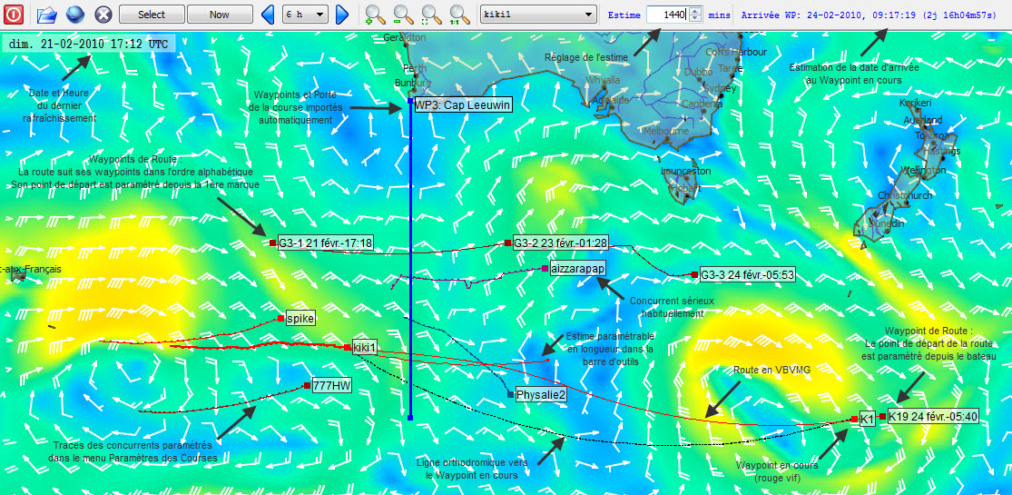
To move the map :
- Up, down, left, right from keyboard
- Wheel click or 'right-click->center the map here' to center the map here.
Zoom/Unzoom
- Keys + or - from the keyboard or magnifying glasses icons from the toolbar.
- Select a zone on the map (left click and drag) and click on 'zoom on selection' on the toolbar
- Click on zoom 1:1 on the toolbar to display entire world
It is possible to memorize 4 predefined map zoom and positions with ctrl-F9 to Ctrl-F12. You can then recall them with F9 to F12.
Viewing the grib file
Use arrows 7 and 9 on (qtVlm toolbar) to change backward/forward the grib current date/time.
- Select the boat
- Display esteem
- Draw a heading (line will flash in red if a collision with coasts is detected)
- Draw a grib Esteem at fix heading or fix TWA (Traçer une estime grib de la route)
- Insert/paste a mark
- Delete marks (if a zone has been selected)
- Draw a heading (line will flash in red if a collision with coasts is detected). If Polar or Compass is displayed the line will starts from the center of the Compass or Polar.
- Draw a grib Esteem at fix heading or fix TWA (Traçer une estime grib de la route)
- Manage compass position, on the boat, on the VLM WP, on route's interpolation cursor.
- Center the map here.
- Edit/Delete/Copy
- Make it the current, active WP "Mon_WP"
- Position the grib at ETA: change the grib's current date to the POI's ETA
- Activate horn (Alarm sound will be played 10mn before POI's ETA). To stop it press ESC
- Draw a heading (line will flash in red if a collision with coasts is detected). If Polar or Compass is displayed the line will starts from the center of the Compass or Polar.
- Draw a grib Esteem at fix heading or fix TWA (Traçer une estime grib de la route)
- Routes: Assign or not this POI to a route
- Edit POI's route
- Optimize POI: will find the best position of this POI, i.e. the position that gives the best ETA for the next POI on the route.
- Delete the route
- Preselect POI for the autopilot: Créer une route
- Navigation mode to this POI: Comportement_du_bateau_selon_le_mode_de_pilotage
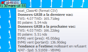
Boat tip
Moving the mouse over a boat displays various information

